
Château du Val d'Auray (ou d'Aulnay) topographic map
Interactive map
Click on the map to display elevation.
About this map
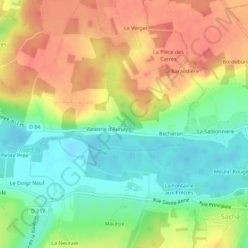
Name: Château du Val d'Auray (ou d'Aulnay) topographic map, elevation, terrain.
Average elevation: 71 m
Minimum elevation: 39 m
Maximum elevation: 106 m
Other topographic maps
Click on a map to view its topography, its elevation and its terrain.
L'Indre
France > Centre-Val de Loire > Azay-le-Rideau
L'Indre, Azay-le-Rideau, Tours, Indre-et-Loire, Centre-Val de Loire, France métropolitaine, 37190, France
Average elevation: 69 m