
Smetlede topographic map
Interactive map
Click on the map to display elevation.
About this map
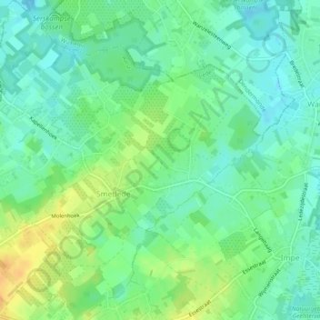
Name: Smetlede topographic map, elevation, terrain.
Location: Smetlede, Lede, Oost-Vlaanderen, Vlaanderen, België (50.95467 3.90848 50.98354 3.94846)
Average elevation: 21 m
Minimum elevation: 9 m
Maximum elevation: 41 m
Other topographic maps
Click on a map to view its topography, its elevation and its terrain.
Oordegem
België > Vlaanderen > Lede > Oordegem
Oordegem, Lede, Oost-Vlaanderen, Vlaanderen, 9521, België
Average elevation: 28 m