
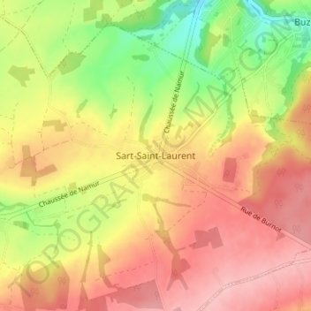
Sart-Saint-Laurent topographic map
Interactive map
Click on the map to display elevation.
About this map
Name: Sart-Saint-Laurent topographic map, elevation, terrain.
Average elevation: 210 m
Minimum elevation: 133 m
Maximum elevation: 268 m
Other topographic maps
Click on a map to view its topography, its elevation and its terrain.
Sart-Eustache
België > Namen > Namen > Fosses-la-Ville
Sart-Eustache, Fosses-la-Ville, Namen, Wallonië, 5070, België
Average elevation: 184 m
Aisemont
België > Namen > Namen > Fosses-la-Ville
Aisemont, Fosses-la-Ville, Namen, Wallonië, 5070, België
Average elevation: 175 m