
Loulé topographic map
Interactive map
Click on the map to display elevation.
About this map
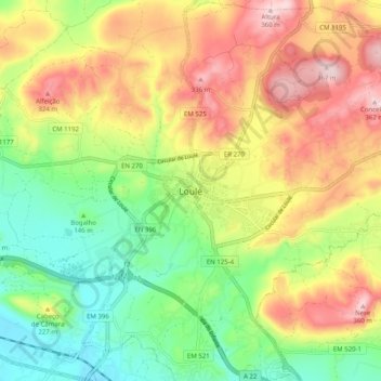
Name: Loulé topographic map, elevation, terrain.
Location: Loulé, Faro, Algarve, 8100-641, Portugal (37.09840 -8.06355 37.17840 -7.98355)
Average elevation: 185 m
Minimum elevation: 40 m
Maximum elevation: 363 m