
Tintay Puncu topographic map
Interactive map
Click on the map to display elevation.
About this map
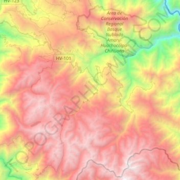
Name: Tintay Puncu topographic map, elevation, terrain.
Location: Tintay Puncu, Tayacaja, Huancavelica, Perú (-12.26683 -74.61530 -12.10188 -74.34315)
Average elevation: 3,079 m
Minimum elevation: 847 m
Maximum elevation: 4,926 m