
Alberni-Clayoquot Regional District topographic map
Interactive map
Click on the map to display elevation.
About this map
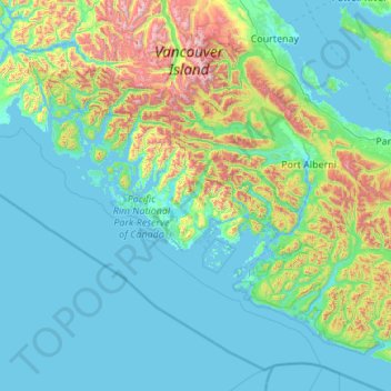
Name: Alberni-Clayoquot Regional District topographic map, elevation, terrain.
Average elevation: 277 m
Minimum elevation: -1 m
Maximum elevation: 2,142 m
Other topographic maps
Click on a map to view its topography, its elevation and its terrain.
Paul Lake
Canada > British Columbia > Thompson-Nicola Regional District > Area P (Rivers and the Peaks)
Average elevation: 926 m
Rosswood
Canada > British Columbia > Regional District of Kitimat-Stikine > Area C (Butedale/Kitlope/Kitsumkalum)
Average elevation: 311 m
Burnaby
Canada > British Columbia > Metro Vancouver Regional District > Burnaby
Burnaby occupies 98.6 square kilometres (38.1 sq mi) and is located at the geographic centre of the Metro Vancouver area and home to the Metro Vancouver regional government in Metrotown. Situated between the city of Vancouver on the west and Port Moody, Coquitlam, and New Westminster on the east, Burnaby is…
Average elevation: 144 m