
Thank you for supporting this site ❤️
Make a donation
Make a donation
Castiglioncello topographic map
Click on the map to display elevation.
Thank you for supporting this site ❤️
Make a donation
Make a donation
About this map
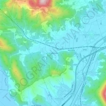
Name: Castiglioncello topographic map, elevation, terrain.
Location: Castiglioncello, Balbano, Lucca, Toscana, 55050, Italia (43.80810 10.37764 43.84810 10.41764)
Average elevation: 72 m
Minimum elevation: -5 m
Maximum elevation: 380 m
Thank you for supporting this site ❤️
Make a donation
Make a donation