
滏阳新河 topographic map
Interactive map
Click on the map to display elevation.
About this map
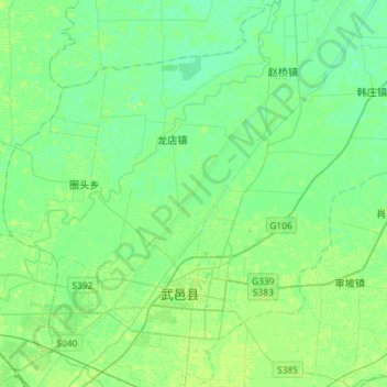
Name: 滏阳新河 topographic map, elevation, terrain.
Location: 滏阳新河, 武邑县, 衡水市, 河北省, 053000, 中国 (37.74448 115.77358 37.97238 116.00327)
Average elevation: 20 m
Minimum elevation: 15 m
Maximum elevation: 23 m