
Doam-myeon topographic map
Interactive map
Click on the map to display elevation.
About this map
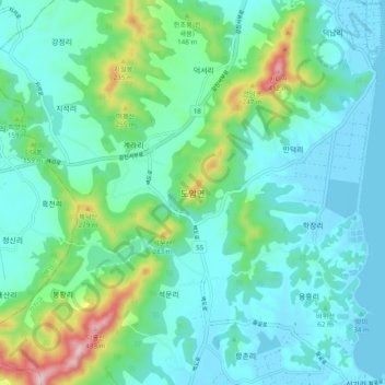
Name: Doam-myeon topographic map, elevation, terrain.
Location: Doam-myeon, Gangjin-gun, South Jeolla, 59250, South Korea (34.52687 126.68371 34.60687 126.76371)
Average elevation: 82 m
Minimum elevation: -3 m
Maximum elevation: 405 m