
Make a donation
Hamilton topographic map
Click on the map to display elevation.
Make a donation
Hamilton
Hamilton's climate is humid-continental, characterized by changeable weather patterns. In the Köppen classification, Hamilton it is on the Dfb/Dfa border found in southern Ontario because the average temperature in July is 22.0 °C (71.6 °F). However, its climate is moderate compared with most of Canada. The airport's open, rural location and higher altitude results in lower temperatures, generally windier conditions, and higher snowfall amounts than lower, built-up areas of the city. The highest temperature ever recorded in Hamilton was 41.1 °C (106 °F) on July 14, 1868. The coldest temperature ever recorded was −30.6 °C (−23 °F) on January 25, 1884.
Make a donation
About this map
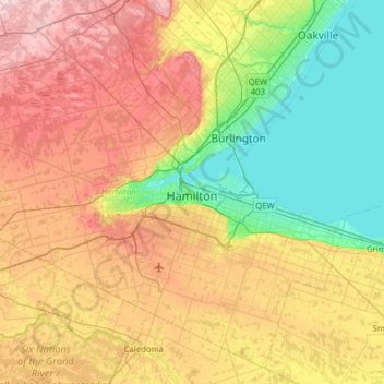
Name: Hamilton topographic map, elevation, terrain.
Location: Hamilton, Golden Horseshoe, Ontario, Canada (43.05051 -80.24856 43.47068 -79.62211)
Average elevation: 187 m
Minimum elevation: 70 m
Maximum elevation: 358 m
Make a donation