
Thank you for supporting this site ❤️
Make a donation
Make a donation
Milborne St Andrew topographic map
Click on the map to display elevation.
Thank you for supporting this site ❤️
Make a donation
Make a donation
About this map
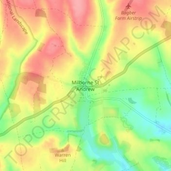
Name: Milborne St Andrew topographic map, elevation, terrain.
Location: Milborne St Andrew, Dorset, England, DT11 0JF, United Kingdom (50.75816 -2.30166 50.79816 -2.26166)
Average elevation: 96 m
Minimum elevation: 51 m
Maximum elevation: 138 m
Thank you for supporting this site ❤️
Make a donation
Make a donation
Other topographic maps
Click on a map to view its topography, its elevation and its terrain.