
Ellis Township topographic map
Interactive map
Click on the map to display elevation.
About this map
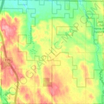
Name: Ellis Township topographic map, elevation, terrain.
Location: Ellis Township, Cheboygan County, Michigan, United States (45.28695 -84.60998 45.37504 -84.48641)
Average elevation: 253 m
Minimum elevation: 200 m
Maximum elevation: 317 m
Other topographic maps
Click on a map to view its topography, its elevation and its terrain.
Burt Lake
United States > Michigan > Cheboygan County
Burt Lake, Tuscarora Township, Cheboygan County, Michigan, 49717, United States
Average elevation: 207 m
Mentor Township
United States > Michigan > Cheboygan County
Mentor Township, Cheboygan County, Michigan, United States
Average elevation: 258 m