
Thank you for supporting this site ❤️
Make a donation
Make a donation
Oxford topographic map
Click on the map to display elevation.
Thank you for supporting this site ❤️
Make a donation
Make a donation
About this map
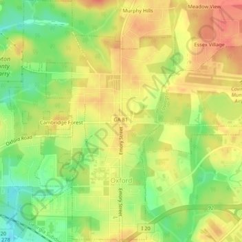
Name: Oxford topographic map, elevation, terrain.
Location: Oxford, Newton County, Georgia, United States (33.61036 -83.88621 33.64405 -83.85842)
Average elevation: 231 m
Minimum elevation: 200 m
Maximum elevation: 253 m
Thank you for supporting this site ❤️
Make a donation
Make a donation
Other topographic maps
Click on a map to view its topography, its elevation and its terrain.