
Thank you for supporting this site ❤️
Make a donation
Make a donation
Sweetwater Station topographic map
Click on the map to display elevation.
Thank you for supporting this site ❤️
Make a donation
Make a donation
About this map
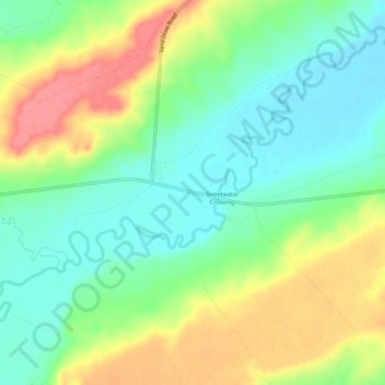
Name: Sweetwater Station topographic map, elevation, terrain.
Location: Sweetwater Station, Fremont County, Wyoming, United States (42.52218 -108.20370 42.56218 -108.16370)
Average elevation: 2,021 m
Minimum elevation: 1,989 m
Maximum elevation: 2,069 m
Thank you for supporting this site ❤️
Make a donation
Make a donation
Other topographic maps
Click on a map to view its topography, its elevation and its terrain.