
Hintertux topographic map
Interactive map
Click on the map to display elevation.
About this map
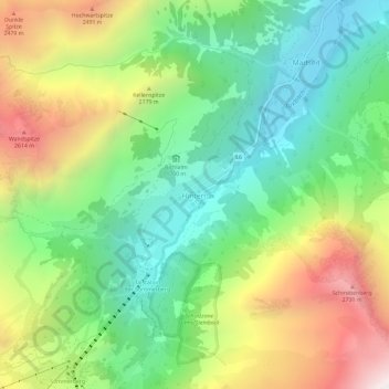
Name: Hintertux topographic map, elevation, terrain.
Average elevation: 1,949 m
Minimum elevation: 1,372 m
Maximum elevation: 2,888 m
Other topographic maps
Click on a map to view its topography, its elevation and its terrain.
Olperer
Österreich > Tirol > Bezirk Schwaz > Gemeinde Tux
Olperer, Gemeinde Tux, Bezirk Schwaz, Tirol, Österreich
Average elevation: 2,935 m
Tux
Österreich > Tirol > Bezirk Schwaz > Gemeinde Tux
Tux, Gemeinde Tux, Bezirk Schwaz, Tirol, 6293, Österreich
Average elevation: 1,625 m