
Thank you for supporting this site ❤️
Make a donation
Make a donation
Qeshm topographic map
Click on the map to display elevation.
Thank you for supporting this site ❤️
Make a donation
Make a donation
About this map
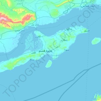
Name: Qeshm topographic map, elevation, terrain.
Location: Qeshm, Hormozgan Province, Iran (26.53781 55.26017 26.99978 56.28742)
Average elevation: 45 m
Minimum elevation: -8 m
Maximum elevation: 1,455 m
Thank you for supporting this site ❤️
Make a donation
Make a donation