
Thank you for supporting this site ❤️
Make a donation
Make a donation
Lindenbos topographic map
Click on the map to display elevation.
Thank you for supporting this site ❤️
Make a donation
Make a donation
About this map
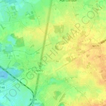
Name: Lindenbos topographic map, elevation, terrain.
Location: Lindenbos, Aartselaar, Antwerpen, 2630, België (51.09334 4.35766 51.13334 4.39766)
Average elevation: 15 m
Minimum elevation: -3 m
Maximum elevation: 28 m
Thank you for supporting this site ❤️
Make a donation
Make a donation