
Pensacola Bay topographic map
Interactive map
Click on the map to display elevation.
About this map
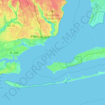
Name: Pensacola Bay topographic map, elevation, terrain.
Average elevation: 7 m
Minimum elevation: -4 m
Maximum elevation: 44 m
Other topographic maps
Click on a map to view its topography, its elevation and its terrain.
Santa Rosa Sound
United States > Florida > Santa Rosa County > Gulf Breeze
Santa Rosa Sound, Gulf Breeze, Santa Rosa County, Florida, United States
Average elevation: 8 m