
Cerro Gordo topographic map
Interactive map
Click on the map to display elevation.
About this map
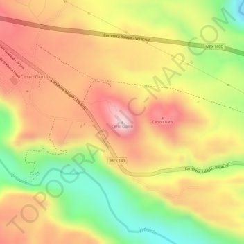
Name: Cerro Gordo topographic map, elevation, terrain.
Location: Cerro Gordo, Emiliano Zapata, Veracruz, México (19.42821 -96.68789 19.42831 -96.68779)
Average elevation: 512 m
Minimum elevation: 313 m
Maximum elevation: 653 m