
Thank you for supporting this site ❤️
Make a donation
Make a donation
Las Orquideas topographic map
Click on the map to display elevation.
Thank you for supporting this site ❤️
Make a donation
Make a donation
About this map
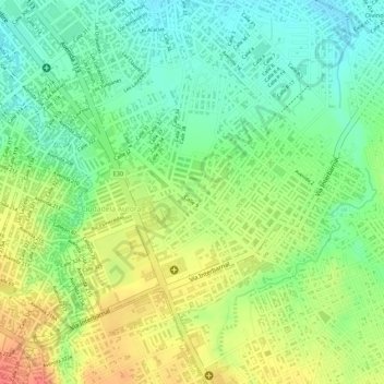
Name: Las Orquideas topographic map, elevation, terrain.
Location: Las Orquideas, Ciudadela Aurora, Manta, Manabí, Ecuador (-0.98027 -80.69337 -0.97861 -80.69213)
Average elevation: 48 m
Minimum elevation: 20 m
Maximum elevation: 81 m
Thank you for supporting this site ❤️
Make a donation
Make a donation
Other topographic maps
Click on a map to view its topography, its elevation and its terrain.