
South Lakes Park topographic map
Interactive map
Click on the map to display elevation.
About this map
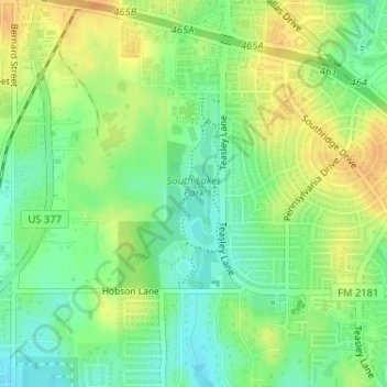
Name: South Lakes Park topographic map, elevation, terrain.
Average elevation: 201 m
Minimum elevation: 185 m
Maximum elevation: 218 m
Other topographic maps
Click on a map to view its topography, its elevation and its terrain.
Cooper Creek
United States > Texas > Denton County > Denton
Cooper Creek, Denton, Denton County, Texas, 76298, United States
Average elevation: 184 m
Mingo
United States > Texas > Denton County > Denton
Mingo, Denton, Denton County, Texas, 76298, United States
Average elevation: 172 m
Green Valley
United States > Texas > Denton County > Denton
Green Valley, Denton, Denton County, Texas, United States
Average elevation: 180 m
North Pointe Park
United States > Texas > Denton County > Denton
North Pointe Park, Denton, Denton County, Texas, 76201, United States
Average elevation: 210 m