
分宜县 topographic map
Interactive map
Click on the map to display elevation.
About this map
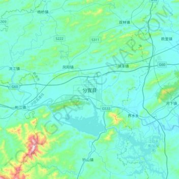
Name: 分宜县 topographic map, elevation, terrain.
Location: 分宜县, 钤东街道, 分宜县, 新余市, 江西省, 中国 (27.65807 114.52530 27.97807 114.84530)
Average elevation: 135 m
Minimum elevation: 44 m
Maximum elevation: 866 m
境内属低山丘陵地形。地势南北部略高,中部较低平。最高峰为大岗山,海拔1091.8米;最低处为分宜镇罗家山北面小溪边,海拨60米。主要河流有袁河等。属亚热带季风型潮湿性天气,年均匀气温17.2度,年均匀降雨量1600毫米,全年无霜期270天。