
Nedrow topographic map
Interactive map
Click on the map to display elevation.
About this map
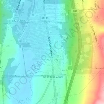
Name: Nedrow topographic map, elevation, terrain.
Average elevation: 174 m
Minimum elevation: 126 m
Maximum elevation: 310 m
Other topographic maps
Click on a map to view its topography, its elevation and its terrain.
Onondaga Hill
United States > New York > Onondaga County > Town of Onondaga > Onondaga Hill
Onondaga Hill, Town of Onondaga, Onondaga County, New York, 13207, United States
Average elevation: 243 m
Howlett Hill
United States > New York > Onondaga County > Town of Onondaga > Howlett Hill
Howlett Hill, Town of Onondaga, Onondaga County, New York, 13022, United States
Average elevation: 271 m