
Landelies topographic map
Interactive map
Click on the map to display elevation.
About this map
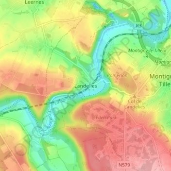
Name: Landelies topographic map, elevation, terrain.
Average elevation: 158 m
Minimum elevation: 100 m
Maximum elevation: 214 m
Other topographic maps
Click on a map to view its topography, its elevation and its terrain.
Bomerée
Belgique > Hainaut > Charleroi > Montigny-le-Tilleul
Bomerée, Montigny-le-Tilleul, Charleroi, Hainaut, Wallonie, 6110, Belgique
Average elevation: 165 m