
Thank you for supporting this site ❤️
Make a donation
Make a donation
Temas topographic map
Click on the map to display elevation.
Thank you for supporting this site ❤️
Make a donation
Make a donation
About this map
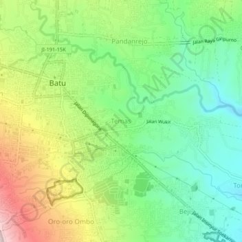
Name: Temas topographic map, elevation, terrain.
Location: Temas, Batu, Lowokwaru, East Java, Java, 65315, Indonesia (-7.89745 112.51753 -7.85745 112.55753)
Average elevation: 855 m
Minimum elevation: 697 m
Maximum elevation: 1,116 m
Thank you for supporting this site ❤️
Make a donation
Make a donation
Other topographic maps
Click on a map to view its topography, its elevation and its terrain.