
Nandasmo (Muncipio) topographic map
Interactive map
Click on the map to display elevation.
About this map
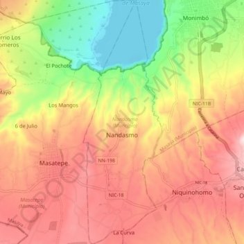
Name: Nandasmo (Muncipio) topographic map, elevation, terrain.
Location: Nandasmo (Muncipio), Masaya, 42400, Nicaragua (11.88589 -86.13404 11.97194 -86.10526)
Average elevation: 358 m
Minimum elevation: 122 m
Maximum elevation: 554 m
Other topographic maps
Click on a map to view its topography, its elevation and its terrain.