
Château de Grillemont topographic map
Interactive map
Click on the map to display elevation.
About this map
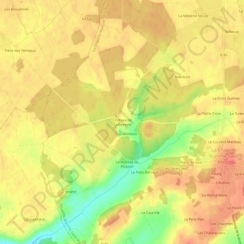
Name: Château de Grillemont topographic map, elevation, terrain.
Average elevation: 112 m
Minimum elevation: 76 m
Maximum elevation: 129 m
Other topographic maps
Click on a map to view its topography, its elevation and its terrain.
Bellevue
France > Centre-Val de Loire > Indre-et-Loire > La Chapelle-Blanche-Saint-Martin > Bellevue
Bellevue, La Chapelle-Blanche-Saint-Martin, Loches, Indre-et-Loire, Centre-Val de Loire, France métropolitaine, 37240, France
Average elevation: 115 m