
Niverville topographic map
Interactive map
Click on the map to display elevation.
About this map
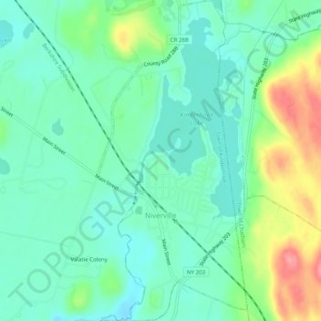
Name: Niverville topographic map, elevation, terrain.
Average elevation: 104 m
Minimum elevation: 76 m
Maximum elevation: 172 m
Other topographic maps
Click on a map to view its topography, its elevation and its terrain.
Valatie Colony
United States > New York > Columbia County > Town of Kinderhook
Valatie Colony, Town of Kinderhook, Columbia County, New York, 12184, United States
Average elevation: 94 m