
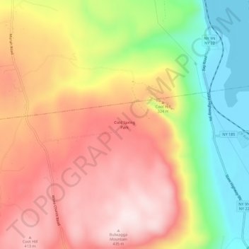
Cold Spring Park topographic map
Interactive map
Click on the map to display elevation.
About this map
Name: Cold Spring Park topographic map, elevation, terrain.
Average elevation: 256 m
Minimum elevation: 26 m
Maximum elevation: 441 m
Other topographic maps
Click on a map to view its topography, its elevation and its terrain.
Burdick Crossing
United States > New York > Essex County > Town of Crown Point
Burdick Crossing, Town of Crown Point, Essex County, New York, 12928, United States
Average elevation: 41 m
Crown Point Center
United States > New York > Essex County > Town of Crown Point
Crown Point Center, Town of Crown Point, Essex County, New York, 12928, United States
Average elevation: 158 m
Factoryville
United States > New York > Essex County > Town of Crown Point
Factoryville, Town of Crown Point, Essex County, New York, 12928, United States
Average elevation: 126 m
Ironville
United States > New York > Essex County > Town of Crown Point
Ironville, Town of Crown Point, Essex County, New York, United States
Average elevation: 326 m