
Thank you for supporting this site ❤️
Make a donation
Make a donation
Champ Fleuri topographic map
Click on the map to display elevation.
Thank you for supporting this site ❤️
Make a donation
Make a donation
About this map
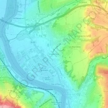
Name: Champ Fleuri topographic map, elevation, terrain.
Average elevation: 213 m
Minimum elevation: 166 m
Maximum elevation: 342 m
Thank you for supporting this site ❤️
Make a donation
Make a donation
Other topographic maps
Click on a map to view its topography, its elevation and its terrain.
69730
France > Auvergne-Rhône-Alpes > Métropole de Lyon > Genay > Les Mignotières
Average elevation: 231 m