
Andros Island topographic map
Interactive map
Click on the map to display elevation.
About this map
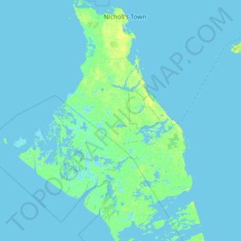
Name: Andros Island topographic map, elevation, terrain.
Location: Andros Island, The Bahamas (24.26893 -78.46197 25.20498 -77.71598)
Average elevation: 1 m
Minimum elevation: -6 m
Maximum elevation: 23 m
Other topographic maps
Click on a map to view its topography, its elevation and its terrain.