
Tyne and Wear topographic map
Interactive map
Click on the map to display elevation.
About this map
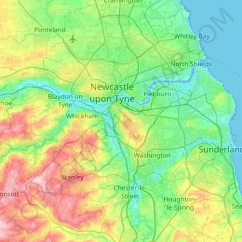
Name: Tyne and Wear topographic map, elevation, terrain.
Average elevation: 82 m
Minimum elevation: -3 m
Maximum elevation: 309 m
Other topographic maps
Click on a map to view its topography, its elevation and its terrain.
Wycliffe
United Kingdom > England > County Durham
Wycliffe, Wycliffe with Thorpe, County Durham, North East, England, DL12 9TS, United Kingdom
Average elevation: 129 m