
Artern topographic map
Click on the map to display elevation.
About this map
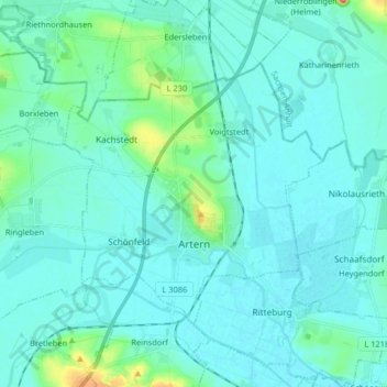
Name: Artern topographic map, elevation, terrain.
Location: Artern, Kyffhäuserkreis, Thuringia, 06556, Germany (51.34167 11.23891 51.41031 11.40156)
Average elevation: 131 m
Minimum elevation: 116 m
Maximum elevation: 239 m
Other topographic maps
Click on a map to view its topography, its elevation and its terrain.
Unterburg
Germany > Thuringia > Kyffhäuserkreis > Kyffhäuserland > Kohlstätte
Average elevation: 301 m