
Cedar Hill Mobile Home Park topographic map
Interactive map
Click on the map to display elevation.
About this map
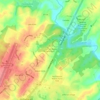
Name: Cedar Hill Mobile Home Park topographic map, elevation, terrain.
Average elevation: 152 m
Minimum elevation: 107 m
Maximum elevation: 194 m
Other topographic maps
Click on a map to view its topography, its elevation and its terrain.
Rivanna
United States > Virginia > Albemarle County > Hollymead
Rivanna, Hollymead, Albemarle County, Virginia, 22936, United States
Average elevation: 162 m