
Julianapark topographic map
Interactive map
Click on the map to display elevation.
About this map
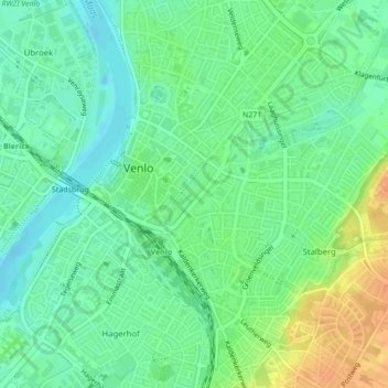
Name: Julianapark topographic map, elevation, terrain.
Location: Julianapark, Venlo, Limburg, Nederland (51.36622 6.17250 51.37059 6.17769)
Average elevation: 25 m
Minimum elevation: 11 m
Maximum elevation: 47 m
Other topographic maps
Click on a map to view its topography, its elevation and its terrain.
Hout-Blerick
Nederland > Limburg > Venlo > Hout-Blerick
Hout-Blerick, Venlo, Limburg, Nederland, 5926 RA, Nederland
Average elevation: 22 m