
Wahgunyah topographic map
Interactive map
Click on the map to display elevation.
About this map
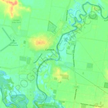
Name: Wahgunyah topographic map, elevation, terrain.
Location: Wahgunyah, Shire of Indigo, Victoria, Australia (-36.04359 146.37599 -35.96217 146.46308)
Average elevation: 142 m
Minimum elevation: 128 m
Maximum elevation: 171 m