
Les Ouches topographic map
Interactive map
Click on the map to display elevation.
About this map
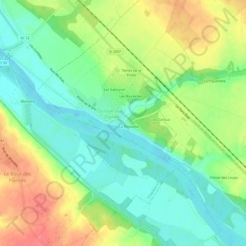
Name: Les Ouches topographic map, elevation, terrain.
Average elevation: 149 m
Minimum elevation: 124 m
Maximum elevation: 185 m
Other topographic maps
Click on a map to view its topography, its elevation and its terrain.
Le Buisson Billat
France > Centre-Val de Loire > Loiret > Ousson-sur-Loire
Le Buisson Billat, Ousson-sur-Loire, Montargis, Loiret, Centre-Val de Loire, France métropolitaine, 45250, France
Average elevation: 150 m