
Tweed Shire Council topographic map
Interactive map
Click on the map to display elevation.
About this map
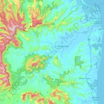
Name: Tweed Shire Council topographic map, elevation, terrain.
Location: Tweed Shire Council, New South Wales, Australia (-28.54273 153.10721 -28.15702 153.58593)
Average elevation: 212 m
Minimum elevation: -3 m
Maximum elevation: 1,178 m
Other topographic maps
Click on a map to view its topography, its elevation and its terrain.