
Bomal topographic map
Interactive map
Click on the map to display elevation.
About this map
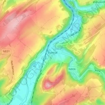
Name: Bomal topographic map, elevation, terrain.
Location: Bomal, Durbuy, Marche-en-Famenne, Luxemburg, Wallonië, België (50.35620 5.50296 50.39620 5.54296)
Average elevation: 201 m
Minimum elevation: 123 m
Maximum elevation: 281 m