
道里区 topographic map
Interactive map
Click on the map to display elevation.
About this map
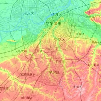
Name: 道里区 topographic map, elevation, terrain.
Location: 道里区, 哈尔滨市, 黑龙江省, 150000, 中国 (45.54751 126.14368 45.78716 126.62906)
Average elevation: 156 m
Minimum elevation: 112 m
Maximum elevation: 215 m
Other topographic maps
Click on a map to view its topography, its elevation and its terrain.