
Elten topographic map
Interactive map
Click on the map to display elevation.
About this map
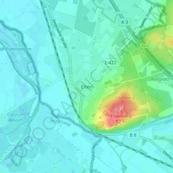
Name: Elten topographic map, elevation, terrain.
Average elevation: 21 m
Minimum elevation: 9 m
Maximum elevation: 81 m
Other topographic maps
Click on a map to view its topography, its elevation and its terrain.
Hüthum
Deutschland > Nordrhein-Westfalen > Kreis Kleve > Emmerich am Rhein
Hüthum, Emmerich am Rhein, Bedburg-Hau, Kreis Kleve, Nordrhein-Westfalen, 46446, Deutschland
Average elevation: 17 m