
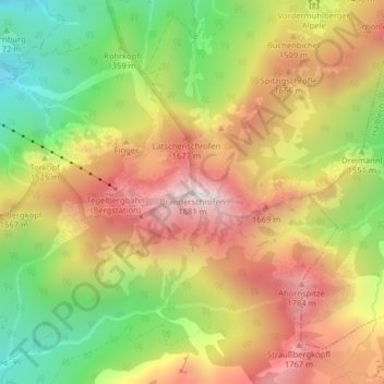
Branderschrofen topographic map
Interactive map
Click on the map to display elevation.
About this map
Name: Branderschrofen topographic map, elevation, terrain.
Average elevation: 1,423 m
Minimum elevation: 966 m
Maximum elevation: 1,860 m
Other topographic maps
Click on a map to view its topography, its elevation and its terrain.
Forggensee
Deutschland > Bayern > Landkreis Ostallgäu > Schwangau
Forggensee, Schwangau, Roßhaupten (VGem), Landkreis Ostallgäu, Bayern, Deutschland
Average elevation: 821 m
Bleckenau
Deutschland > Bayern > Landkreis Ostallgäu > Schwangau
Bleckenau, Schwangau, Landkreis Ostallgäu, Bayern, Deutschland
Average elevation: 1,435 m
Horn
Deutschland > Bayern > Landkreis Ostallgäu > Schwangau
Horn, Schwangau, Landkreis Ostallgäu, Bayern, 87645, Deutschland
Average elevation: 812 m