
Thank you for supporting this site ❤️
Make a donation
Make a donation
Sürth topographic map
Click on the map to display elevation.
Thank you for supporting this site ❤️
Make a donation
Make a donation
Sürth
Der Ort liegt an der Wipperfürther Straße östlich von Broch. Unmittelbar nördlich grenzt auf einer kleinen Anhöhe der mittelalterliche Ringwall Burgring an.
Thank you for supporting this site ❤️
Make a donation
Make a donation
About this map
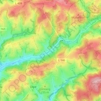
Name: Sürth topographic map, elevation, terrain.
Average elevation: 238 m
Minimum elevation: 170 m
Maximum elevation: 310 m
Thank you for supporting this site ❤️
Make a donation
Make a donation
Other topographic maps
Click on a map to view its topography, its elevation and its terrain.
51515
Deutschland > Nordrhein-Westfalen > Rheinisch-Bergischer Kreis > Kürten > Waldmühle > Kettenberg
Average elevation: 218 m