
Fiss topographic map
Interactive map
Click on the map to display elevation.
About this map
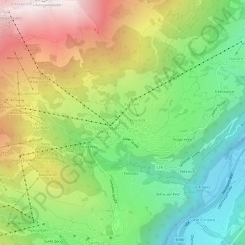
Name: Fiss topographic map, elevation, terrain.
Location: Fiss, Gemeinde Fiss, Bezirk Landeck, Tirol, 6533, Österreich (47.03715 10.59662 47.07715 10.63662)
Average elevation: 1,545 m
Minimum elevation: 877 m
Maximum elevation: 2,493 m