
Jasper County topographic map
Interactive map
Click on the map to display elevation.
About this map
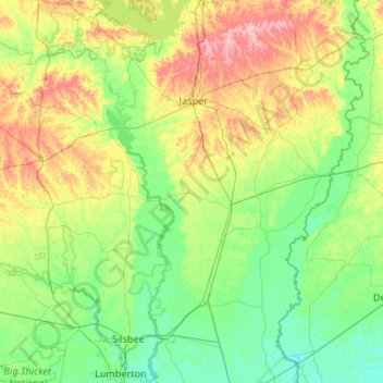
Name: Jasper County topographic map, elevation, terrain.
Location: Jasper County, Texas, United States of America (30.24174 -94.46019 31.15818 -93.86562)
Average elevation: 44 m
Minimum elevation: 1 m
Maximum elevation: 180 m
Other topographic maps
Click on a map to view its topography, its elevation and its terrain.