
Tenere topographic map
Interactive map
Click on the map to display elevation.
About this map
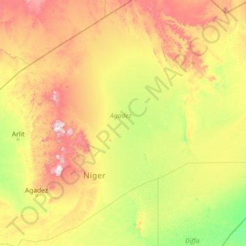
Name: Tenere topographic map, elevation, terrain.
Location: Tenere, Arlit, Agadez, Niger (16.11871 8.60421 22.28252 16.69510)
Average elevation: 549 m
Minimum elevation: 304 m
Maximum elevation: 1,844 m
Other topographic maps
Click on a map to view its topography, its elevation and its terrain.