
Pampilhosa topographic map
Interactive map
Click on the map to display elevation.
About this map
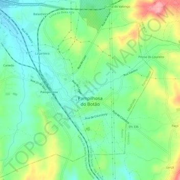
Name: Pampilhosa topographic map, elevation, terrain.
Location: Pampilhosa, Mealhada, Aveiro, Portugal (40.31808 -8.45234 40.35733 -8.40134)
Average elevation: 97 m
Minimum elevation: 56 m
Maximum elevation: 177 m
Other topographic maps
Click on a map to view its topography, its elevation and its terrain.
Lagarteira
Portugal > Aveiro > Mealhada > Pampilhosa
Lagarteira, Pampilhosa, Mealhada, Aveiro, 3050-444, Portugal
Average elevation: 87 m