
趵突泉街道 topographic map
Interactive map
Click on the map to display elevation.
About this map
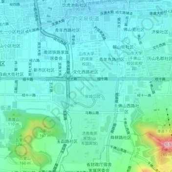
Name: 趵突泉街道 topographic map, elevation, terrain.
Location: 趵突泉街道, 历下区, 济南市, 山东省, 250000, 中国 (36.63168 117.00630 36.66226 117.02258)
Average elevation: 69 m
Minimum elevation: 29 m
Maximum elevation: 266 m
Other topographic maps
Click on a map to view its topography, its elevation and its terrain.