
Duncan topographic map
Interactive map
Click on the map to display elevation.
About this map
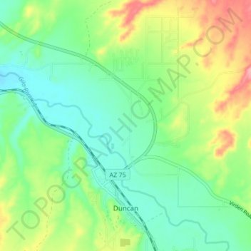
Name: Duncan topographic map, elevation, terrain.
Location: Duncan, Greenlee County, Arizona, United States (32.70546 -109.11462 32.76269 -109.07694)
Average elevation: 1,140 m
Minimum elevation: 1,102 m
Maximum elevation: 1,214 m
Other topographic maps
Click on a map to view its topography, its elevation and its terrain.
Hannagan Meadow
United States > Arizona > Greenlee County
Hannagan Meadow, Greenlee County, Arizona, United States
Average elevation: 2,749 m
Morenci
United States > Arizona > Greenlee County
Morenci, Greenlee County, Arizona, 85533, United States
Average elevation: 1,246 m
Duck Corral Tank
United States > Arizona > Greenlee County
Duck Corral Tank, Greenlee County, Arizona, United States
Average elevation: 2,391 m
Clifton
United States > Arizona > Greenlee County
Clifton, Greenlee County, Arizona, United States
Average elevation: 1,194 m