
Thank you for supporting this site ❤️
Make a donation
Make a donation
Wyoming Range topographic map
Click on the map to display elevation.
Thank you for supporting this site ❤️
Make a donation
Make a donation
About this map
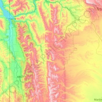
Name: Wyoming Range topographic map, elevation, terrain.
Location: Wyoming Range, Lincoln County, Wyoming, United States (42.53392 -110.72901 43.30120 -110.57044)
Average elevation: 2,357 m
Minimum elevation: 1,703 m
Maximum elevation: 3,419 m
Thank you for supporting this site ❤️
Make a donation
Make a donation
Other topographic maps
Click on a map to view its topography, its elevation and its terrain.